
Coquitlam, one of the three Canadian cities involved in an insurance-industry backed pilot program to access threats of climate change, has ruled that new developments on the Fraser River must be set further and higher back from the water.
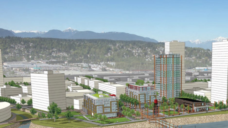
The policy change will require the Waterfront Village Centre, a 36-hectare development planned by Beedie Development on the former Fraser Mills site, to be built up about one meter higher than previous municipal standards. This would increase the foundation height to about 4.5 metres (or 14.5 feet.)
The development will also be set back sufficiently from the river to allow a dike to be built in the event of an historic flood, according to Dan Soong, manager of utility programs for the City of Coquitlam.
David Gormley, Beedie vice-president of land development, said the change came as no surprise. “We already build up at least six metres above water level,” he said, adding that most Metro municipalities have similar regulations.
The water protection measures are needed because water damage has now surpassed home fires as the most costly insurance claim in the country, according to the Insurance Bureau of Canada.
Insurable losses in 2013 toppled over the $3 billion mark for the first-time in Canadian history. Over half that total, $1.7 billion, was related to water damage resulting from record flooding. Insurable losses related to water and wind damage in 2013 were more than 40 times the amount recorded in 1983, according to bureau data.
“What climate change is doing is giving us more extreme storms, more extreme rainfall events,” Soong said.
“What we are seeing is, every year, billions of dollars in catastrophic losses,” said Robert Tremblay, the insurance bureau’s director of research.
“An extreme weather event that would occur every 50 years is now happening once every five to seven years, depending on where you are in the country,” he said.
The insurance bureau has pinned its hopes on reducing future claims on an innovative new software program specifically designed to help cities better plan for and guard against flooding caused by severe weather.
The Municipal Risk Assessment Tool (MRAT), which is still being fine-tuned, is currently being tested in three pilot cities: Coquitlam, Hamilton, Ont. and Fredericton, NB. The initiative, developed by the insurance bureau with the aid of federal funding, uses different climate models, past rainfall events and municipal data to predict areas of the city that are particularly vulnerable to flooding. The data can be used by cities to make necessary improvements before problems occur.
Tremblay called the MRAT the “most advanced analytical tool of its kind that currently exists.”
Soong is the MRAT technical expert in Coquitlam, where sewer backs up are common, resulting in dozens of complaints every year from unhappy citizens in this fast-growing city of 126,000. Soong knows there will be plenty more rainy days ahead and he wants the city to be as prepared as possible.
“This tool will help us,” he said.


