
Twenty years ago, getting around Metro Vancouver took time. Going by car was fastest, although traffic on Highway 1 through Surrey and Langley often slowed things down. Since then, rush-hour traffic has only worsened. Road capacity in Metro Vancouver simply hasn’t kept pace with population growth, with the region having the least amount of highway per capita in a Colliers International survey of major metropolitan areas across North America.
Given the choice between high insurance rates and other vehicle ownership costs and time spent stuck in traffic, many Vancouver residents have opted to spend their money on housing close to amenities that include transit and car-sharing services.
Upgrades to transit over the past 20 years mean that a trip to deepest Langley now takes two hours from the core, as opposed to three hours. Lions Bay, a popular backcountry hiking destination, is little more than 90 minutes away. Connections are smoother thanks to wireless communications and big data that keep the various parts in sync. Rapid transit lines have multi-use trails alongside them ideal for cyclists, who can connect with hundreds of kilometres of routes in municipalities across the region.
While transit capacity lags in some areas, and trail improvements are ongoing, it’s easier than ever to travel the region without owning a car. The following is a brief guide to your options if you’re new to the area.
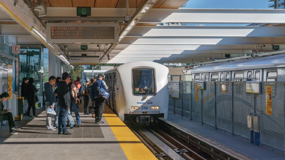
Transit ■ Transit is the default travel option for most city dwellers who want to travel more than walking distance, especially during the cold, wet months of winter. Buses are the most economical, with one fare allowing travellers to move across the region any day of the week; connecting to the SkyTrain rapid transit system, the SeaBus passenger-only ferry between North Vancouver and downtown Vancouver, and the West Coast Express commuter railway invite higher fares based on distance travelled. There are three zones for SkyTrain, SeaBus is a two-zone fare, and West Coast Express has four zones that take travellers as far as Mission. (For a map of key regional transit connections, see pages 26–27.)
Compass is the region’s transit fare card. Available for $6 apiece at transit stations and select locations of London Drugs, the cards can be loaded with cash for single trips or passes covering a day or a month of travel.
Google Maps is a good tool to plan the various options for making it quickly between two addresses, but TransLink – which oversees transit services within Metro Vancouver – also offers a trip planner. Apps such as Radar allow commuters to check the whereabouts of local buses in real time by searching a route or stop number.
Metro Vancouver’s transit system connects with those in the Fraser Valley and, via BC Ferries, on Vancouver Island. In addition, several private operators offer shuttles for distances as short as across False Creek or as far as Whistler.
Public trails ■ Those keen on exercise, and for whom the elements are a minor consideration (end-of-trip facilities exist at a growing number of workplaces), can take advantage of the region’s extensive trail networks. These include the BC Parkway that parallels the SkyTrain Expo Line to Surrey, and the Central Valley Greenway alongside the SkyTrain Millennium Line through Burnaby and toward Port Coquitlam. Here, the Trans Canada Trail network runs east through Pitt Meadows to Langley along some of the region’s 600 kilometres of dikes. Well-developed cycling networks in each city allow cyclists to reach local destinations for work and play.
Trip planning is easy with the help of Google and cycling maps from municipalities, TransLink and the Great Trail app. The latter is designed to help users navigate the Trans Canada Trail network, but it highlights plenty of other routes besides.
Many walking routes connect with transit. Cyclists, on the other hand, can either rent lockers at transit exchanges or take their bikes aboard at no extra charge (no more than two at a time on buses, however). TransLink provides a free shuttle for cyclists using the George Massey Tunnel between Delta and Richmond.
Vehicle sharing ■ Ride-sharing services aren’t legal in Vancouver, but that hasn’t stopped Chinese-language apps like Raccoon Go and Udi Kuaiche from making inroads. Car-sharing services such as Modo, a local co-op originally launched in 1997, and Evo, a venture of the British Columbia Automobile Association, compete against Car2Go and Zipcar. Most of the services, like the bike-sharing network Mobi, are membership-based. They’re also best suited for short trips within the city or not far beyond. Since services like Evo and Car2Go depend on vehicles being available to other users, there are incentives to keep them within reach rather than, say, in Whistler or Abbotsford.
Still, when the costs of renting a car for a day or two each month are added up over the course of a year, it often comes out to less than what many people pay for insurance. While ownership has its privileges, the key one associated with vehicles is convenience. But for the contemporary urban dweller, freedom from the costs associated with ownership is an even greater reward.


