
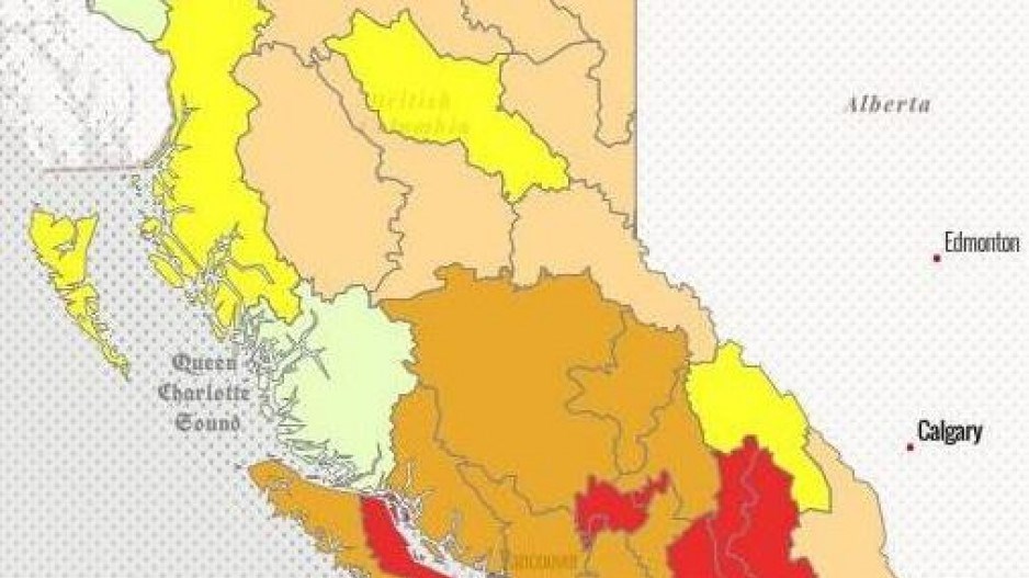
Three regions of B.C. including Eastern Vancouver Island and Gulf Islands, are now officially classed as being in level 4 drought.
There are five levels in the provincial drought rating system, from 0 to 5.
Many parts of B.C. have received no rain for five weeks now, putting three regions in a level 4 drought classification:
- the Salmon River, Coldwater River and Nicola River watersheds in the Thompson-Okanagan;
- the Kettle River, Lower Columbia Basin, and West Kootenay Basin; and
- Eastern Vancouver Island Basin and Gulf Islands
Regions currently under a level 3 drought classification include the entire Okanagan Valley, Similkameen, South Coast and Lower Mainland, Cariboo-Chilcotin, North and South Thompson Basins and parts of Western Vancouver Island.
Some freshwater fishing closures are now in place, as low river levels and higher water temperatures can increase stress on fish.
Increaded heat typically can also bring increased use of water. According to Metro Vancouver, daily water consumption was1.79 billion litres on June 27, which was just short of a record set in 2009.
At this point, British Columbians in drought areas are asked to conserve water. The province warns that if voluntary measuers are not sufficient to conserve water, and drought conditions worsen, enforced measures can be implemented under the Water Sustainability Act.
Industry is being asked to reduce non-essential water use, farmers are asked to use scheduled irrigation based on real-time weather data and ordinary citizens are asked to stop washing their cars, reduce lawn watering, water only in the evenings and take shorter showers.


