
Environment Canada has issued a red alert for B.C. over the next few days, as two more back-to-back rain storms move in.
In response, the B.C. ministry of Transportation and Infrastructure plans to temporarily close several highways -- which only recently reopened -- on Saturday, as a precaution.
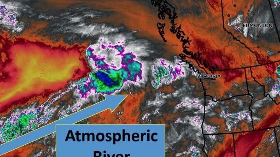
The red alert is unusual, Environment Canada meteorologist Armel Castellan admitted Friday in a press technical briefing, but so is the fact B.C. is being hammered by so many back-to-back deluges from an atmospheric river so early in the year.
Normally, the Pacific Northwest can expect about 10 of these heavily laden atmospheric rivers over the fall and winter, Castellan said.
But they arrived early this year, in increased intensity, and have pounded a landscape already altered by summer wildfires, which can increase runoff. And the fact they have arrived so early means there is little snowpack in the mountains, which typically absorbs some of the precipitation.
The first atmospheric river pounded B.C. between November 13 and 15, dumping more than 200 millimetres of rain in some areas, causing massive floods and landslides that cut roads and railways, and claimed four lives.
The next system will move through this weekend – Saturday and Sunday -- and storm number three is expected to arrive between Tuesday and Wednesday.
“These are coming back-to-back-to-back, with very little time in between,” Castellan said.
The ground is already saturated from the first storm, so even if rainfall isn’t as heavy as the first storm, it may still cause flooding and swell rivers. There has also been some snow in higher elevations.
“They’re going to be adding snowmelt to the rainwater and creating a lot of runoff,” Castellan said.
While meteorologists can generally estimate when a storm system will move in, they can’t pinpoint just how much rain will fall or where. A worst-case scenario would be a deluge like the one that happened between November 13 and 15.
“The worst case scenario is still not super likely for Tuesday and Wednesday being as bad as what we saw in the middle of the month, but it does exist,” Castellan said.
The River Forecast Centre has issued high stream flow advisers for most of the coast and a flood warning for the Sumas River.
As a precaution, the ministry of Transportation and Infrastructure announced Friday it will temporarily close Highway 3 between Hope and Princeton, and Highway 99 between Pemberton and Lillooet on Saturday afternoon. Highway 1 in the Fraser Canyon will also be closed.
For updates on road conditions and closures, visit the ministry's road closure advistory page.
Anyone travelling over the next few days should check road conditions through DriveBC, and be prepared with emergencies supplies in their cars, in the event they get stranded in between flooded highways or landslides, and homeowners in flood plains should be prepared to evacuate.


