
The provincial government announced Thursday it is investing $38 million in a LiDAR (light detection and ranging) remote sensing mapping system to help resource-based companies, governments and interest groups make decisions on where they intend to operate.
Using the same optical technology that provides distance sensing in self-driving vehicles, a plane equipped with a laser sends a short pulse of light that measures the distance to the target and is reflected back to provide three-dimensional profiles of the surface.
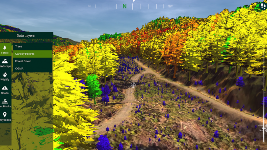
It can be used for natural and man-made environments, on land and in water. The high-resolution models of ground elevation images LiDAR produces will result in accurate shoreline maps that can assess flood risk and help with the province’s response to emergencies. It can be used to map entire cities and can detect changes such as unstable slopes that threaten infrastructure.
When the project is complete, sometime in the next six years, it will result in an open-source LiDAR image map of the entire province that is fully accessible to the public.
“This is a gamechanger because when we’re doing things like conservation or forestry policy you’ve got to start with data, what does the forest look like, how much is there, what are the other values, and LiDAR is the best mapping we have,” said Nathan Cullen, BC Minister of Water, Land and Resource Stewardship, who jointly unveiled the LiDAR plan with Minister of Forests Bruce Ralston at the BC Council of Forest Industries convention in Prince George.
“So knowing what the canopy cover’s like, knowing what the forest floor is like, how vulnerable is the space to fire – all of those values that would be really interesting and that, traditionally, you have to go out and walk. We only have 11 per cent of the province right now covered that way and by the time you cruise the province you’ve got to cruise it again because it’s so big.”
Cullen says industry and First Nations groups have been advocating for LiDAR mapping for years. The technology has been used privately by some B.C. companies but only for smaller-scale projects because of the expense of obtaining data.
The province will first target and prioritize the areas most in need of the service, Cullen said.
“It just helps them be much more informed and efficient with their own forestry plans with way less waste, going into the right blocks at a more specific level,” said Culllen. “It’s just far better for the environment and the economy.”


